
Author: Raymonde Bieler
Currently, around two-thirds of the global population face exposure to extreme heat for 20 or more days each year (C40). According to the European Health Institute, extreme heat killed more than 60 000 people in Europe alone in 2022. Projections from the Intergovernmental Panel on Climate Change (IPCC) paint a worrisome picture of annual average temperature increases, posing a significant challenge for the development of resilient cities.
Extreme heat poses a danger to human health, particularly among vulnerable demographics, causing dehydration, heat strokes, cardiovascular complications, and kidney diseases. It also has adverse effects on people’s overall well-being and quality of life by limiting time people spend outdoors. Additionally, in urban areas it exacerbates building overheating, consequently spiking energy demand on the hottest days of the year.
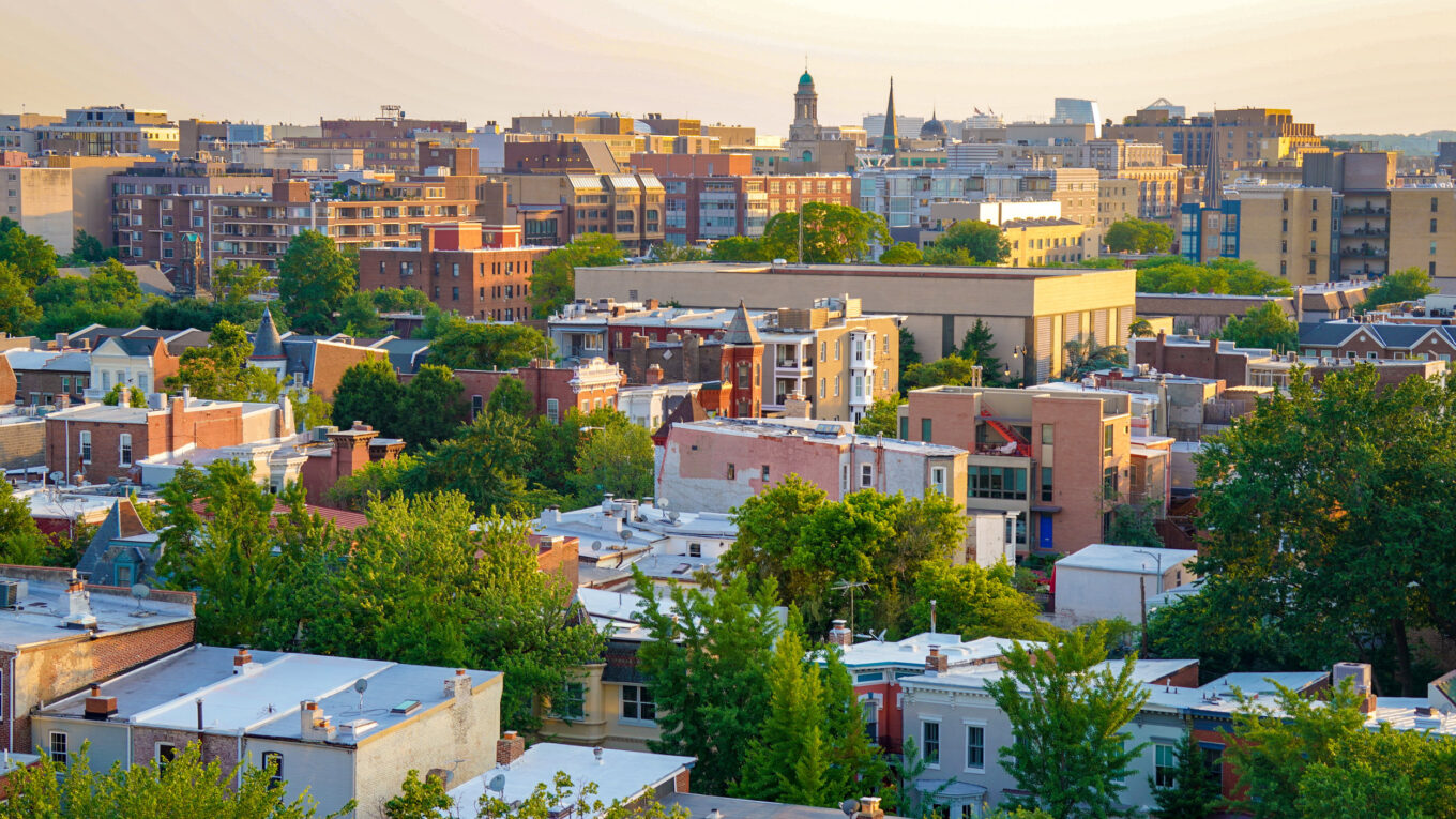
Heatwaves are worse in cities due the Urban Heat Island (UHI) effect which is caused by the increased capacity of buildings, roads and infrastructure to absorb and re-emit solar radiation, compared to natural surroundings. For instance, in London, the recorded temperature can be as much as 10 degree warmer than the surrounding countryside (UK.gov). The UHI effect can be attributed to various components of the built environment, primarily building arrangement and surface material. The lack of impermeable surfaces and green spaces means that urban settings lack the cooling effect caused by evaporation and the natural shade provided by vegetation. Another crucial factor is anthropogenic heat, generated by human activities such as vehicular traffic.
I had the chance to investigate this phenomenon as part of an internal research initiative at White Arkitekter linked with a major masterplan we worked on in Quebec, Canada. In collaboration with our sustainability specialist, we developed a digital tool to analyse the impact of architectural proposals on human comfort by comparing various proposals against current climate data and future emission scenarios developed by the IPCC.
Our UHI mitigation workflow comprises a series of tools that enables the testing of different design alternatives to identify the most effective strategies for reducing the UHI effect. The study’s findings underscore the central role of vegetation in significantly reducing temperatures in specific areas. According to the results, by the year 2080, under the same proposal, an additional 30% of the area will be exposed to temperatures exceeding 38 degrees compared to present climate conditions. However, introducing greener streets with trees in the proposal can mitigate this, reducing the area exposed to such high temperatures to just 35% when compared to the proposal lacking greenery.
The conclusion highlights the pressing need for proactive and environmentally conscious urban planning that considers the transformative impact of vegetation as well as the importance of long-term thinking to equip ourselves with a better understanding of our city’s future needs.
Mitigation strategies: design tools
Multi-functional streets
30% of our cities are made up of streets which consist predominantly of heat-absorbing hard surfaces. All vehicles are a source of anthropogenic heat contributing to higher temperature. Our research in Quebec shows streets with multiple functions outperform those solely designed for vehicular movement. This approach allocates space for greenery, stormwater management, and amenities promoting walking and cycling, reducing car dependency. This multi-use approach supports a greater social activity while reducing the amount of concrete and asphalt.
Accessibility to green spaces
When addressing thermal comfort, density and massing are also key factors to consider. Providing the right balance between built form and accessible green areas plays a critical role in establishing cooler public zones within urban environments. Moreover, the creation of comfortable tree-lined streets can help ensure that even the most vulnerable part of the population can safely walk outside during periods of extreme heat.
Large-scale thinking
Quebec’s government has proactively developed an urban heat map, facilitating the identification of UHI-affected areas for strategic mitigation. To optimise effectiveness, large-scale measures are crucial, involving the creation of cooling networks through green corridors across urban landscapes. The role of wind is equally significant. Grid orientation, massing and the understanding of wind behaviour are vital considerations. The challenge is to prevent wind tunnels that can cause winter discomfort while harnessing breezes to help mitigate summer heatwaves.
The study of microclimates and the pursuit of thermal comfort are vital aspects to consider when envisioning the cities of the future. This methodology can help empower designers in early stages of design in creating strong arguments for the greening of cities by being able to assess and measure its impact. Greening is not only an important mitigation strategy for urban heat islands, but it also has a wide range of positive impact in cities, such as, biodiversity, leisure and well-being, and stormwater management. The aim is to bring the conditions for creating resilient cities that are walkable and rich in biodiversity!
Sources
- C40, https://www.c40.org/news/how-nature-is-combatting-the-climate-crisis-in-cities/
- Intergovernmental Panel on Climate Change
- UK.gov, https://www.london.gov.uk/programmes-and-strategies/environment-and-climate-change/climate-change/climate-adaptation/heat
Credit (for development of the methodology): Thiago Ferreira, Sustainability specialist, White Arkitekter
Photo by Ted Eytan